91 descriptions
The website of Archives de Montréal (Ville de Montréal) is down (for about 4 hours)
Its images and links won't load until it's back. Panarchive shows each image straight from the archive's own website, so when that site is down the picture can't be shown here. Nothing is lost: everything returns once the archive is back up, and we check every few minutes.
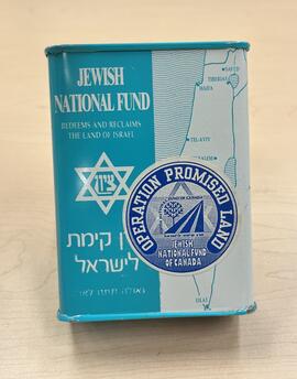 Jewish National Fund collection tin
 1759-1: Spy plan of the town and fortification of Montreal or Ville Marie in 1758. - [19-] (original créé en 1758)
 1761-2: The isles of Montreal as they have been survey'd by the french engineers. - Copié le 16 décembre 1945 (original paru en janvier 1761)
 1795-1: Plan of part of the Province of Lower Canada containing the country from the River Montmorency near Quebec upwards as far as any surveys have been hitherto made. - [19-] (original créé en 1795)
 1798-1: Plan montrant l'ouverture de la rue Saint-Laurent et des prinicipales artères sur l'île de Montréal. - [19-] (original créé le 15 juillet 1798).
 1802-1: Plan of the Town and Fortifications of Montreal showing the Reserves now proposed to be made for Military purposes 1802. - Copié partiellement le 10 avril 1819 (original créé le 11 novembre 1802)
 1815-1: Town of Montreal with the rocks shoals sounding &c. in the harbour, showing also the improvements, projected canal, squares &c. - [19-] (original créé en 1815)
 1815-2: Portion centrale de la carte de Montréal publiée par Joseph Bouchette. - 23 septembre 1947 (original créé en 1815)
 1822-1: Proposed distribution of lots to be sold on & near the Citadel Hill in Montreal. - Copié le 17 décembre 1946 (original créé le 10 janvier 1822)
 1823-3: A plan of the city of Montreal. - 29 octobre 1952 (original créé le 1er septembre 1823)
 1825-1: Map of the city and suburbs of Montreal. - Copié en décembre 1915 (original créé en 1825)
 1825-2: Plan montrant les prolongements de pierre empêchant les navires de longer la rive à Montréal. - Copié le 17 décembre 1946 (original créé le 21 novembre 1825)
 1830-1: City of Montreal. - [19-] (original créé en 1830)
 1833-1: Plan of a projected division into building lots of a property in the City of Montreal belonging to B. Berthelet, Esq. M. D. - Copié le 8 novembre 1949 (original créé le 24 février 1833)
 1834-1: Plan des faubourgs St-Joseph et St-Antoine avec les nos. du terrier. - [19-] (original créé en 1834)
 1834-8: Plan exhibiting the property of the Heirs B. Proulx and the space of the Beach and River required for the contemplated additons to the new market in the city of Montreal. - Copié le 27 janvier 1949 (original créé en décembre 1834)
 1835-1: Plan of the subdivision of part of the property of Herman Sever [sic] at the current St Mary. - Copié le 5 décembre 1949 (original créé le 14 septembre 1835)
 1836-1: Conduites de l'aqueduc, bornes fontaines, égoûts et bâtisses principales de la ville. - 1836
 1836-2: Plan of the survey and subdivision into building lots, of part of the property of the Heirs of the late Herman Seaver, at the current Saint Mary. - Copié le 2 décembre 1949 (original créé en mai 1836)
 1838-1: Plan of the survey of the property of Thomas Phillips Esquire near the city of Montreal, commonly called Beaver Hall property. - Copié le 4 janvier 1949 (original créé le 7 mai 1838)
 1839-1: Plan of the city of Montreal from a survey made by order of the Mayor & Common Council in 1835 with the new improvements to 1839. - [19-] (original créé en 1839)
 1840-1: Système de l'Aqueduc et principales bâtisses de la Ville. - 1840
 1840-2: Extrait:- "Atlas Montréal 1840". - Copié le 2 mars 1948 (original créé en 1840)
 1841-1: Montreal city showing the proposed embankment F &c. (in yellow) and proposed tunnel C.C. - 29 mai 1841
 1841-2: West Bank of Rr St. Lawrence from the River St Pierre to the Cross at St Marys showing the general position of the proposed embankment F. & c. and tunnel C.C. - 29 mai 1841
 1842-1: Survey of an Estate, the property of J. S. Cartwright & J. B. Forsyth fronting on St Mary Street, Quebec suburbs, within the limits of the City of Montreal. - Copié le 14 octobre 1948 (original créé en 1842)
 1843-1: Map of the city of Montreal. - 1893 (original créé en 1843)
 1843-2: The province of Canada. - 3 mars 1843
 1843-3: Plan of the Centre Ward Montreal. - 10 octobre 1843
 1843-3: Plan of the East Ward Montreal. - 1843
 1843-3: Plan of the West Ward Montreal. - 21 novembre 1843
 1843-3: Plan partiel du quartier Saint Antoine à Montréal. - 1843
 1843-3: Southern section of the Saint Lawrence Ward Montreal. - 1843
 1843-4: Plan no 6074 des divisions cadastrales entre les rues Dorchester et De la Gauchetière. - Copié le 29 septembre 1949 (original créé le 15 septembre 1843)
 1846-1: Extrait d'un plan de la ville de Montréal par James Cane. - Copié en janvier 1949 (original créé en 1846)
 1846-2: Topographical and Pictorial map of the City of Montreal. - Copié en janvier 1949 (publié en 1846)
 1847-1: Plan of building lots belonging to Benjamin Brewster, situated between the Lachine Canal and the Lachine T.P. Road, Montreal. - 10 février 1847
 1848-1: Plan of the city of Montreal with the latest improvements. - 1848-1852
 1848-2: Plan of the city of Montreal. - [19-] (original créé en 1848)
 1850-1: Plan of Dalhousie Square situate [sic] in the City of Montreal made at the instance of her Majesty's Board of Ordnance to annex to process. - Copié le 15 octobre 1949 (original créé en 1850)
 1851-1: Plan of the Quebec Gate Barracks, Garrison Hospital &c. to accompany the returns nos 1 to 9 as called for the Honble. Boards Circular no 1560. - Copié le 17 décembre 1949 (original créé le 10 janvier 1851)
 1851-2: Map of the City of Montreal shewing [sic] the latest improvements. - 1851
 1852-1: Plan of the City of Montreal shewing [sic] the direction of the Water pipes together with the Steam Water Works reservoirs and hydrants. - 1852
 1852-2: Tableau de l'incendie du 8 juillet 1852 à Montréal. - 15 juillet 1852
 1853-1: Map of the City of Montreal with the latest improvements. - 1853
 1853-2: Sketch of Gabriel Farm. - [19-] (original créé en 1853)
 1853-3: Map of the City of Montreal compiled from the most recent surveys. - 1853
 1853-4: Survey of lands Pointe St Charles Montreal acquired by the provincial government from the seminary of Montreal, the Hotel-Dieu nunnery & the Grey nunnery. - [19-] (original créé en 1853)